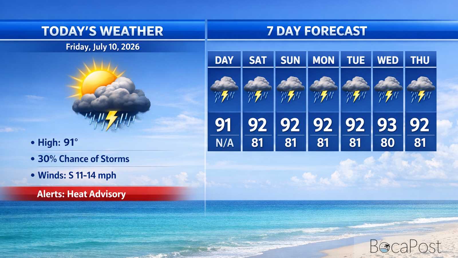
Today's Weather - Friday, July 10, 2026
BOCA RATON, FL — Expect a hot, mostly sunny Friday with a high near 91 and heat index values up to around 108. A few showers and thunderstorms may develop this afternoon, mainly between about 2 p.m. and 5 p.m., but many neighborhoods stay dry. East winds run 11–14 mph with occasional higher gusts, keeping the coast breezy. Tonight turns mostly clear and warm near 81, with only a small chance of a late-night shower or storm
South Florida’s weather pattern is shifting again today, and the big story for Boca Raton is still the heat—now paired with rising humidity. The National Weather Service notes that high pressure over the western Atlantic remains in control at the surface, keeping an east to southeast breeze in place.
That onshore flow helps push moisture back in, which is why it may feel even more uncomfortable than the last couple of days even if the air looked “clearer.” A disturbance aloft is also moving closer from the southeast. In plain terms, that feature helps lift air and makes it easier for clouds to grow into thunderstorms.
The forecast discussion highlights that the drier, dusty air that had been sitting over the region is moving out, while moisture increases through the day. That supports a better chance for afternoon storms today and again Saturday.
For Boca Raton specifically, storm coverage still looks hit-or-miss, with the best window in the afternoon and early evening. If a storm forms nearby, expect brief heavy rain, frequent lightning, and a quick burst of gusty wind.
For the Boca Raton-area Atlantic waters (Jupiter Inlet to Deerfield Beach), southeast winds run about 10–15 knots today with seas around 2 feet, building to 2–3 feet tonight. The Intracoastal will be a moderate chop today, easing to lighter chop this weekend as winds relax.
Boaters should watch for afternoon and evening thunderstorms today and Saturday—storms can bring sudden gusts, rougher short-period waves, and dangerous lightning even when seas are otherwise low. Beachgoers will notice a steady onshore breeze; if thunder is heard, get off the sand and out of the water immediately.
Current Advisories / Watches / Warnings
- Heat Advisory
7 Day Outlook
- Friday (Jul 10): Mostly sunny and very hot, high near 91 with heat index up to about 108. A 30% chance of afternoon thunderstorms (best 2–5 p.m.). Breezy east winds 11–14 mph.
- Saturday: Another steamy day near 92 with heat index around 108. Storm chances tick up to 40% after 2 p.m., still not an all-day washout. Winds lighter from the southeast.
- Sunday: Drier trend with plenty of sun and a high near 92. With fewer storms around, heat can feel more relentless during the afternoon. Light southeast winds increase a bit late day.
- Monday: Mostly sunny and hot near 92 with a 20% chance of a late-day thunderstorm. Humidity stays high, so plan for heat stress if you’re outside for long stretches.
- Tuesday: Sunny and hotter, high near 93. Only a small (20%) afternoon storm chance. Expect typical summer heat with limited rain relief for most neighborhoods.
- Wednesday: Mostly sunny with a 20% chance of showers and thunderstorms. High near 92. Any storms that form will be brief but could bring lightning and a quick downpour.
- Thursday: Hot and mostly sunny near 93 with a 20% chance of a passing shower or storm. If rain stays scarce, heat index values may continue running in the 105–110 range.
Get the latest Boca Raton Weather update for Friday, July 10, 2026, including heat advisory details, storm timing, and a look ahead at the week.