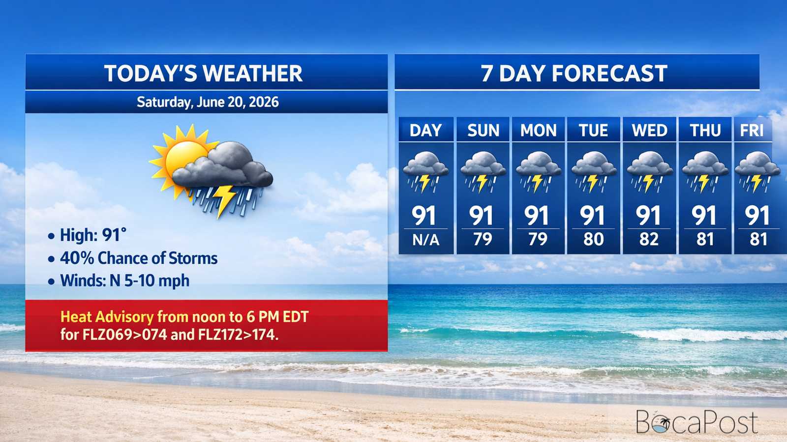
Severe Weather Alert - Saturday, June 20, 2026
BOCA RATON, FL — Boca Raton and the surrounding Broward/Palm Beach area should stay on alert Saturday evening as thunderstorms linger despite the expiration of a severe thunderstorm warning for northern Broward County at 6 p.m. The storm weakened, but the National Weather Service says gusty winds and heavy rain are still possible, with additional pop-up storms expected through the evening in a slow-moving pattern.
While the immediate severe threat has eased, residents in and around Boca Raton should not let their guard down. Slow storm motion can quickly turn heavy rain into street flooding, especially in low-lying neighborhoods and areas with poor drainage.
Brief wind gusts can still knock down small branches, blow around unsecured patio furniture, and create hazardous driving conditions on I-95, Florida’s Turnpike, and major east-west routes during downpours. Lightning remains one of the biggest dangers with any thunderstorm in South Florida.
If you hear thunder, move indoors immediately and stay away from windows. Boaters, beachgoers, golfers, and anyone at parks or outdoor sports should be ready to pause activities quickly.
If you encounter water-covered roads, turn around—visibility can drop fast, and flooded streets may hide deeper water. The broader setup also includes oppressive heat.
Marine Update: Thunderstorms near the coast can produce sudden wind gusts, frequent lightning, and sharply reduced visibility in heavy rain. Boaters near the Boca Raton and Deerfield Beach area should monitor radar, have a safe harbor plan, and head in early if storms approach.
Important Information
- Severe Thunderstorm Warning for northern Broward County expired at 6:00 PM EDT Sat Jun 20, 2026.
- Lingering impacts: gusty winds and heavy rain still possible with thunderstorms.
Track the latest Boca Raton and South Florida storm updates from the National Weather Service Miami office and local radar as conditions change quickly.