Today's Weather - Friday, April 24, 2026
BOCA RATON, FL (Boca Post) (Copyright © 2026) — Today starts on the cloudier side, then trends mostly sunny in Boca Raton with a high near 79. A brief shower is possible, and a thunderstorm can’t be ruled out after late morning, but coverage should stay limited. Winds will be light from the southeast, helping keep it warm but not overly breezy. The bigger safety concern is at the beach: rip currents remain a serious risk along the Atlantic shoreline, especially north toward Palm Beach County
South Florida’s weather pattern is staying fairly steady, but it’s slowly turning a bit more “springlike” with extra moisture and a few more hit-or-miss showers. The National Weather Service notes that a weak ridge of high pressure aloft is being worn down as a disturbance in the upper atmosphere moves across the region.
At the same time, a larger storm system over the eastern U.S. is pushing a front into the Southeast by Saturday.
That front won’t sweep through Boca Raton today, but it helps shape the overall setup and keeps the atmosphere from fully drying out. For Boca Raton, the practical impact is simple: more clouds around at times, and a better chance for a quick shower or isolated thunderstorm during the afternoon.
The air mass has been moistening quickly, and forecasters expect scattered showers to become more common heading into Saturday, even if many locations stay dry for long stretches. Most rain should be light to moderate, but any storm that does form can briefly dump heavier rain.
Boating conditions off Boca Raton and the nearby Atlantic waters remain generally benign today and through the weekend, with southeast winds around 10 knots and seas around 2 feet. Intracoastal waters should see only light chop.
The main marine wildcard is isolated to scattered showers and a few thunderstorms, mainly in the afternoon; winds and seas can briefly kick up near any storm. For the coast, the surf and nearshore currents remain the bigger issue: a high rip current risk continues along the Atlantic beaches, with the most persistent risk focused north into Palm Beach County through this evening.
Current Advisories / Watches / Warnings
- High Rip Current Risk through this evening for FLZ168.
- High Rip Current Risk until 8 AM EDT this morning for FLZ172-173.
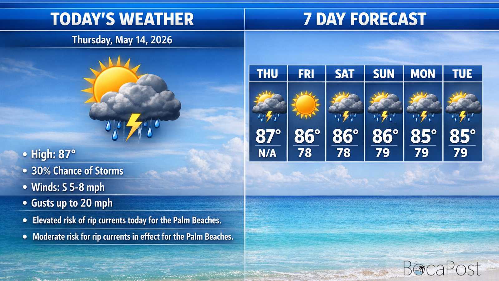
7 Day Outlook
- Friday: Cloudy early, then mostly sunny with a high near 79. A stray shower or thunderstorm is possible after late morning, but many neighborhoods stay dry. Light southeast breeze.
- Saturday: Mostly sunny and warmer, high near 81. A few afternoon showers or thunderstorms may pop up after mid-afternoon. Winds stay light, generally from the east to southeast.
- Sunday: Warm with more sun than clouds, high near 83. A low-end chance of afternoon showers and an isolated thunderstorm, with light winds that may turn more southerly at times.
- Monday: Mostly sunny and warmer, high near 84. A brief afternoon shower or thunderstorm remains possible, then quieter overnight. Winds trend west then turn easterly later.
- Tuesday: Sunny and drier, high near 83. This looks like a more stable day with fewer clouds and little to no rain. Light east breeze develops during the morning.
- Wednesday: Continued sunshine with a warm afternoon near 84. Dry air holds in, keeping rain chances very low. Expect comfortable morning lows and a bright, warm afternoon.
- Thursday: Sunny and warmer, high near 85. Dry conditions continue with light winds. Heat builds gradually, especially in the afternoon, with plenty of sun for most of the day.
Get the latest Boca Raton Weather outlook, including today’s shower chances, warming trend, and the ongoing rip current risk along the Atlantic beaches.